-
Courses

Courses
Choosing a course is one of the most important decisions you'll ever make! View our courses and see what our students and lecturers have to say about the courses you are interested in at the links below.
-
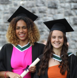
University Life
University Life
Each year more than 4,000 choose University of Galway as their University of choice. Find out what life at University of Galway is all about here.
-
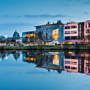
About University of Galway
About University of Galway
Since 1845, University of Galway has been sharing the highest quality teaching and research with Ireland and the world. Find out what makes our University so special – from our distinguished history to the latest news and campus developments.
-
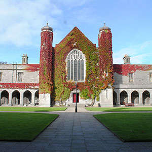
Colleges & Schools
Colleges & Schools
University of Galway has earned international recognition as a research-led university with a commitment to top quality teaching across a range of key areas of expertise.
-
Research & Innovation
Research & Innovation
University of Galway’s vibrant research community take on some of the most pressing challenges of our times.
-
Business & Industry
Guiding Breakthrough Research at University of Galway
We explore and facilitate commercial opportunities for the research community at University of Galway, as well as facilitating industry partnership.
-
Alumni & Friends
Alumni & Friends
There are 128,000 University of Galway alumni worldwide. Stay connected to your alumni community! Join our social networks and update your details online.
-
Community Engagement
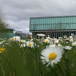
Community Engagement
At University of Galway, we believe that the best learning takes place when you apply what you learn in a real world context. That's why many of our courses include work placements or community projects.


Current Research
The transitional and coastal (TraC) waters are one of the most ecologically and economically important environments on Earth yet they are also some of the most threatened. By bringing freshwater pollutants to seas, the TraC waters can experience diverse impacts such as coastal eutrophication, plastic and toxic pollution. With the current climatic trend, growth in population, industrialisation, urbanisation and overuse of emerging contaminants, the maintenance of "good water quality status" for future generations seems problematic. The adequate monitoring of TraC waters is crucial to our ability to understand and disentangle the effects of pressures and environmental change on aquatic ecosystems. The conventional monitoring programmes rely on insitu and laboratory measurement schemes, which are costly, labour-intensive, and time-consuming processes. They are also limited in terms of spatial coverage and temporal frequency. In this context, the overarching aim of the proposed AquaMon project is to develop a comprehensive infrastructural framework for the automation of water quality monitoring programme and multi-pollutant assessment in TraC waters across the EU. This novel tool will integrate state-of-the-art in engineering, science and IT, and utilize the advanced solutions (Internet of Things, water quality models, machine learning, artificial intelligence and cloud computing) to predict, forecast, statistically evaluate states of TraC water quality and environment in near-real time, as well as to generate reports and detect breaches in fully automated process. The AquaMon framework, when validated for selected sites and optimised for new locations will provide the cost effective and reliable tool to be rolled out across all EU member states. AquaMon is a 3-year long collaborative research project conducted by three highly-specialized teams of researchers (IE-UoG, NL-WUR, PL-WUST). The project will build on the existing research expertise and previous research projects. The research proposal directly targets the Water4All call topic 2 that aims at development and improvement of tools for water resources management. AquaMon addresses the knowledge gaps in our understanding of limitations and challenges of existing monitoring programme in general and in context of hydroclimatic extreme events, as the changes in hydrology due to extreme events have a range of impacts on water quality. We will address these issues with a new approach that will integrate different types of information (IE-WQI, MARINA models, artificial intelligence) to better understand the water quality status of TraC waters from different perspectives (e.g. ecological, multipollutant) and at different scales. While the newly developed IE-WQI model will be used for water quality assessment, the newly developed MARINA models will be used to develop a multipollutant index to better understand which pollutants (nutrients, plastics, antibacterial agents) enter coastal waters from European rivers, from which sources (e.g., cities, agriculture) and basins. The automated smart water quality monitoring system proposed in this project (topic 2.3) will allow to continuously monitor parameters and draw inference about water quality at different timescales form near-real time to long-term climatic changes. The rich monitoring database will be used to draw inferences about water quality dynamics, and therefore to provide knowledge and evidence to be used for policy recommendations, water resource managements and to deliver risk management strategies, adaptation and mitigation measures (topic 2.1). In overall, the AquaMon project will bring forward the water quality monitoring and multi-pollution assessment into the 21st century and improve the capacity of the EU monitoring programmes. This research is a vital component in delivering on wider economic and societal ambitions of the EU member states.
Since mid-20th century there has been observed a continuous deterioration of their quality across Europe. Irish transitional and coastal (TraC) waters are threatened by the synergistic effects of multiple environmental pressures such as nutrient enrichment, oxygen depletion and acidification among others. An implementation of the Water Framework Directive (WFD) requires all surface waters in the EU to achieve at least good status; with just over 30% of transitional waters and 79% of coastal waters at good or high status, this requirement has not been achieved in Ireland. In this light, the monitoring of surface water environments, as required by WFD, is immensely important to understand and disentangle the effects of pressures and environmental change on aquatic ecosystems. However, conventional monitoring approaches based on in-situ data collection and laboratory analysis can be very expensive and time consuming while limited in terms of spatial coverage and temporal frequency. Additional source of data such as remote sensing data, which allow frequent surveys over large areas, can help to address problems associated with these complex interactions. Thus, as the Earth observation records become more available and accurate, the RS data have now the potential to provide an invaluable, cost effective complementary data for operational monitoring, optimization and assessment of surface waters.
The overarching aim of the proposed AquaCop research project is to exploit Copernicus data to improve efficiency, accuracy and implementation of coastal water monitoring programmes. This will be achieved in a multiple-step process by assessing the accuracy of available CMEMS products and developing the location-specific optically active and inactive RS products to complement and optimize the existing monitoring programme, and ultimately by developing the coastal water quality index model for TraC waters (by using advanced artificial intelligence and machine learning techniques) to further support the monitoring programme and draw inference about water quality and trophic statuses. This project will bring forward the data collection into the 21st century and improve the capacity of monitoring programmes to take account of the highly complex spatial and temporal dynamics of TraC waters. The project will also generate a significant step forward in our understanding of nutrient cycling, feedbacks, water quality problems and environmental stressor/pressures on aquatic environment related to human activities including climate change. AquaCop will integrate optimized in-situ data with remotely sensed data streams to facilitate more accurate assessment of water quality and cost-effective management of WQ monitoring. The project will also propose the RS data-driven CWQI model that can support assessment of water quality in TraC waterbodies. Such comprehensive datasets will provide knowledge and evidence to be used for policy recommendations, water resource managements and to deliver risk management strategies and mitigation measures. As such the project outcomes will be of interest to TraC data users, ranging from scientists to water management professionals and the interested general public. In overall, this research is driven by legislation and binding international agreements which require informed responses on key environmental issues, and is a vital component in delivering on wider environmental, economic and societal ambitions.
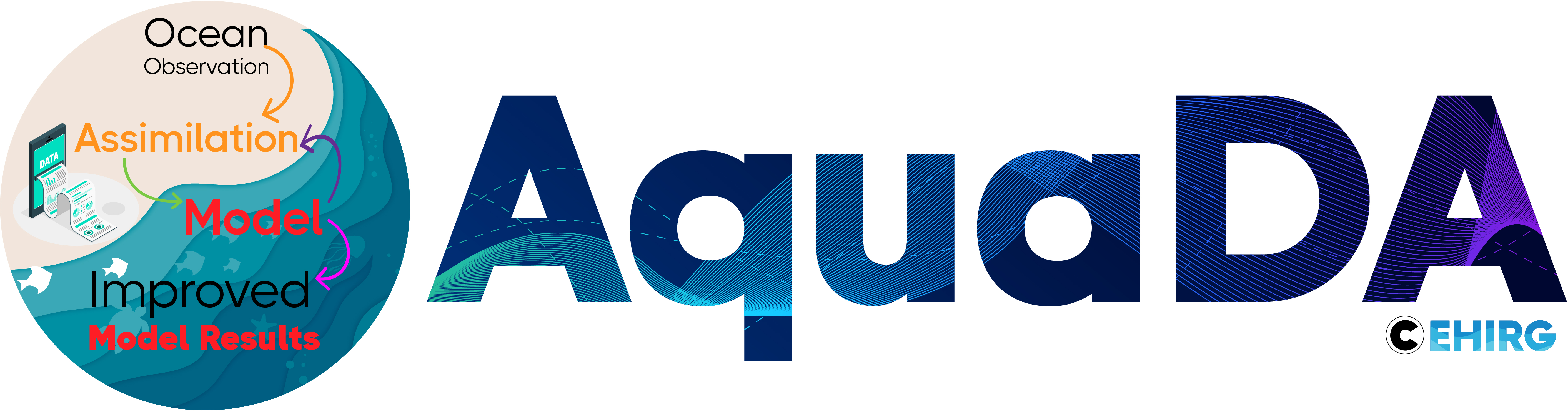 Coastal ocean is a dynamic, complex region where offshore and nearshore processes interact and create physical and biogeochemical conditions suitable for rich ecosystems and blue-growth. In Irish coastal waters, hydrodynamic and biogeochemical dynamics of these systems is simulated by the ROMS Marine Institute operational modelling system (MIOMS) consisting of three dynamically linked models: NE Atlantic and embedded within Connemara and Bantry Bay models. While the system accuracy and performance are generally satisfactory, recent developments in ocean observations and improved numerical algorithms provide a new opportunity to further reduce diverse sources of model uncertainties in the MIOMS through data assimilation (DA) and soft modelling techniques. In this project, a range of DA techniques including 3DVAR, Newtonian nudging, optimal interpolation and Kalman filter will be applied to MIOMS and tested for model accuracy and computational efficiency. Model skill will be assessed on temporal and spatial scales by a range of statistical methods for a range of ensemble members. Data for assimilation will be provided from in-situ observations collated by the Marine Institute (MI), high frequency radar system operated by NUI Galway and Copernicus remotely sensed products. Further, pushing the limits of model forecasting skill, stochastic parameterizations based on static and dynamic approaches will be applied to model parameters that describe physical processes (eg. turbulence, wind stress, bottom friction) to better account for and ultimately reduce model errors. Finally, the forecasting skill of MIOMS will be further improved by applying a robust soft-computing, supervised machine learning algorithms such as artificial neural networks and decision trees (random forests). Ultimately, spatial and temporal information from the MIOMS forecast and reanalysis will be used to assess effectiveness of current MI observation system for operational purposes and to propose an optimized, informative, cost-efficient observing network (in-situ, satellite observations, models) for downstream services (extreme surges, HABs, search/rescue operations).